| Height: | 229.00 ft | (69.80 m) | Elevation: | 6,457 ft (1,968 m) | GPS Latitude: | 36.56411 |
| Volume: | 32,610 ft3 | (923 m3) | Creek: | Little Deer Creek | GPS Longitude: | -118.76839 |
| Width: | 23.50 ft | 7.16 m | Grove: | Giant Forest | Discovery Date: | 1989 |
| Age: | Park: | Sequoia NP | Discovered By: | Wendell D. Flint | ||
| Michael W. Law |
Notes: Hazelwood, named for the nearby Hazelwood Nature Trail, was once considered the world's 17th largest tree (trunk volume of 36,228 ft3 (1,026 m3)). In June 2002, Hazelwood lost over 3,600 ft3 (102 m3) in volume after a lightning strike. Hazelwood remains the 17th largest tree in Sequoia National Park and the 13th largest tree in Giant Forest.
Drive: Hazelwood is 218 mi (351 km) southeast of San Francisco near Fresno.
Northbound: From U.S. Interstate 5 North, transfer to California State Route 99 North toward Bakersfield. Drive north 97 mi (156 km) on California State Route 99 and transfer to California State Route 198 East toward Visalia. Drive east 57 mi (92 km) on California State Route 198 (Generals Highway), past Four Guardsmen, and turn left into the Giant Forest Museum parking lot.
Southbound: From U.S. Interstate 5 South in Sacramento, transfer to U.S. Highway 50 East toward South Lake Tahoe. Drive east 1.7 mi (2.7 km) on U.S. Highway 50 and transfer to California State Highway 99 South. Near Fresno, transfer to California State Route 180 East. Drive east 56 mi (90 km) on California State Route 180, and turn right onto California State Route 198 West. Drive south 29 mi (47 km) on California State Route 198 (Generals Highway) and turn right into the Giant Forest Museum parking lot.
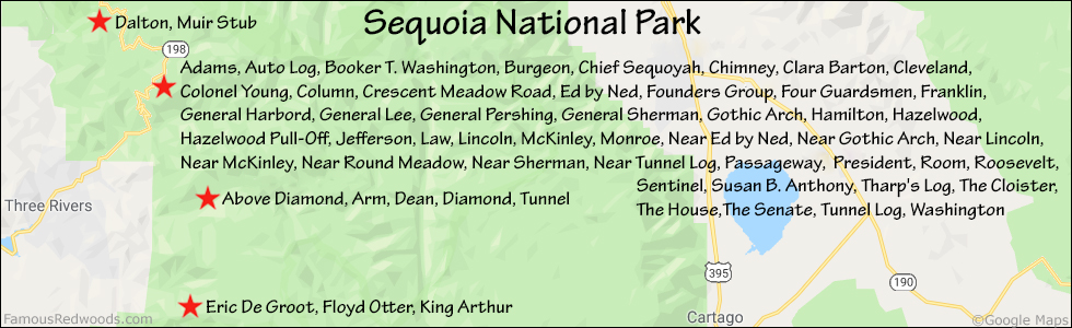
Hike: From the parking lot, hike east/downstairs 300 ft (91 m), across California State Route 198 (Generals Highway), toward Giant Forest Museum and Sentinel, which stands between the highway and Giant Forest Museum. From Sentinel, hike northeast 220 ft (67 m), past the Trail Center, to the trailhead. Hike east 0.2 mi (0.3 km) on Big Trees Trail, past the junction with Bear Hill Trail to the juction with Alta Trail. Turn right at the trail junction and hike east 220 ft (67 m) on Alta Trail (also known as Hazelwood Nature Trail) to the trail exit point near 36.56452 -118.76820. Leave the trail here and hike south/uphill 150 ft (46 m) to Hazelwood.
| Rating: | Easy | One-Way Distance: | 0.4 mi | (0.6 km) | Ascent: | 89 ft | (27 m) |
| Time: | 20 min | Off-Trail: | 150 ft | (46 m) | Descent: | 96 ft | (29 m) |

View Hazelwood Tree location in Google Maps
Panorama: Click panorama to take a virtual tour of Hazelwood Tree

Photos: Pictures of Hazelwood Tree taken from different sides


